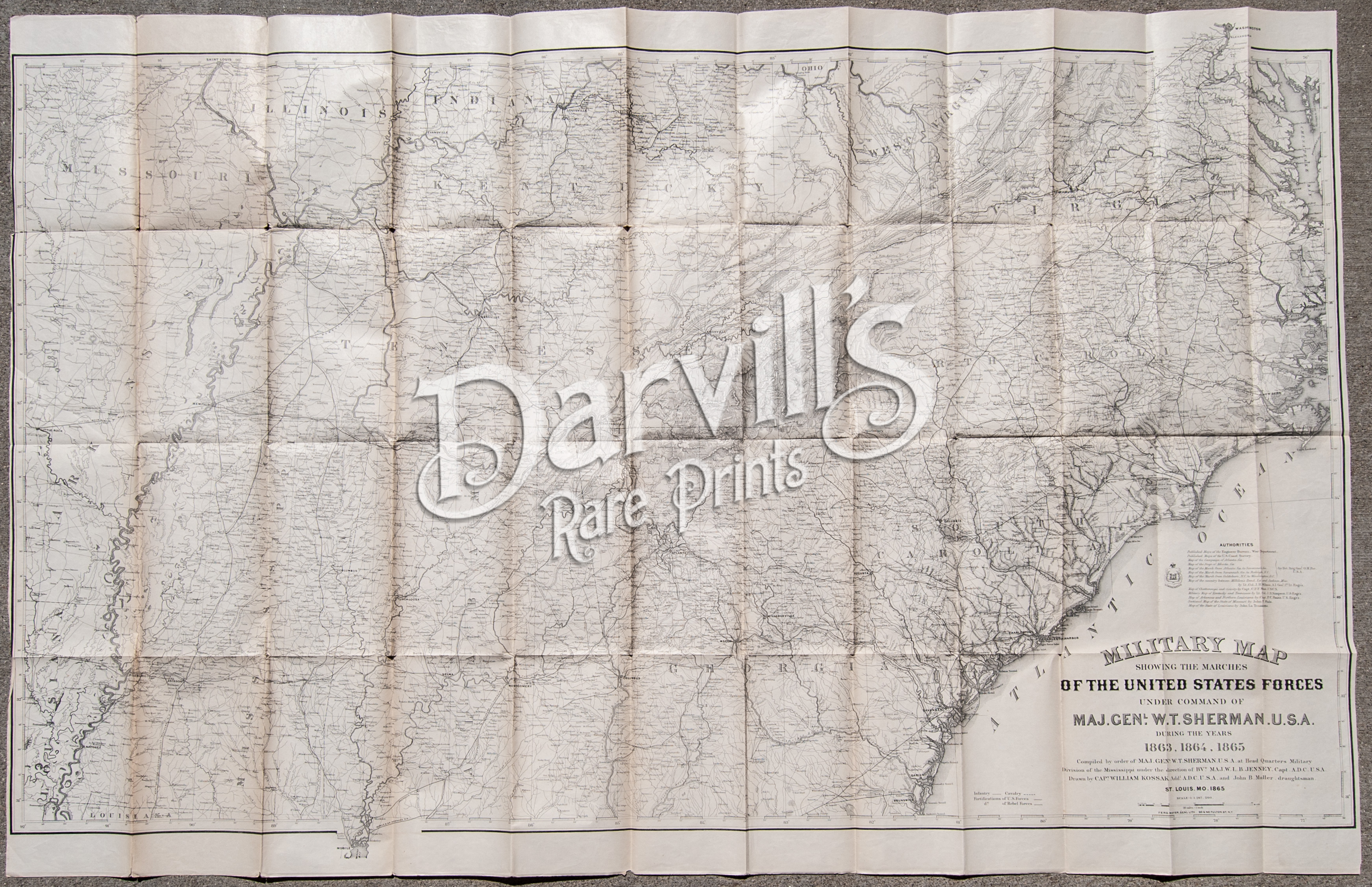
Compiled by order of Maj. Genl. W.T. Sherman, U.S.A.
at Head Quarters Military Division of the Mississippi under direction of
BVt. Maj. W. L.B. Jenney, Capt. A.D.C. U.S.A.
Drawn by Capt. William Kossak, Addl. A.D. C. U.S.A. and John B. Muller, draughtsman
St. Louis, MO
(1865)
- Engraved at Head Qrs, Corps of Engineers, U.S.A. by H.C. Evans & F. Courtenay
Overall size of this huge map is 46 3/4 x 30 inches (118.75 x 76.2 cm)
Map to be shipped folded to original size
This is an original engraved map from the year 1865, over 150 years old. We do NOT sell reproductions
Condition is excellent. There is minor, age-appropriate toning along the fold lines and a few small separations at the fold intersections. Minor edge and corner wear. Left and right margins are narrow (as issued).
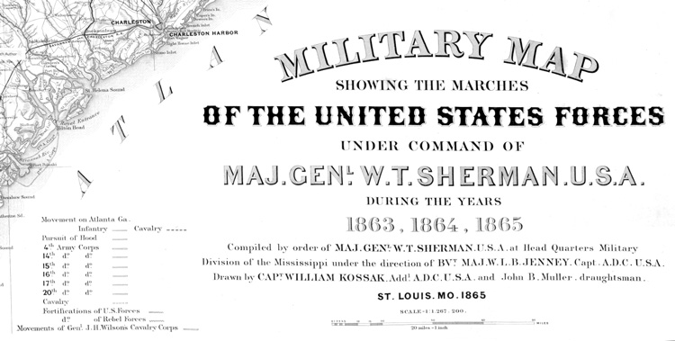
(detail from map; entire map shown below) |